CONTACT INFORMATION

Location: Gravias 4Α, 15125 – Marousi

Phone.: +302106302000

Fax: +302106302991

E-mail: info@helpe-patraikos.gr

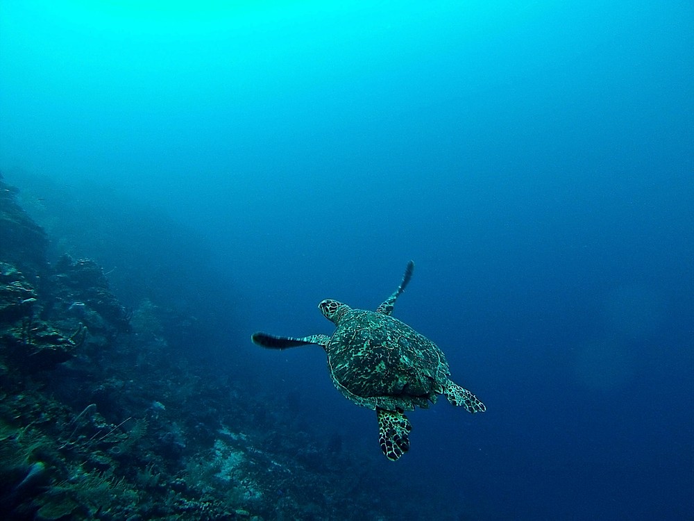
HELLENiQ UPSTREAM KYPARISSIAKOS GULF in collaboration with the Laboratory of Marine Geology & Natural Oceanography of the University of Patras, carried out an Underwater Noise Monitoring Program throughout the course of marine geophysical surveys in Ionian Block and Block 10 (Kyparissiakos). This Program focused on measurements of underwater noise in real time (before, during and after the completion of the exploration activities). The Department of Marine Life, specialized at the University of Patras, recorded the sound level of underwater noise in real time, fully confirming that the noise levels due to geophysical surveys, never exceeded those levels that could cause nuisance or acoustic trauma to marine mammals.

In any case, the scientific data recorded, fully confirmed the simulation of the produced sound levels, but also the limits of the Exclusion Zone which were strictly observed in the field of work with immediate application of mitigation measures (immediate cessation of geophysical acquisition) in case in case they are located within the EZ.

perivallon

SOUND LEVELS AND DISTRIBUTION DURING MARINE SEISMIC ACQUISITION

During marine geophysical surveys (seismic acquisition) sound is produced by the release of compressed air released by the air guns into the water. The sound is reflected at the bottom and recorded by arrays of hydrophones dragged behind the vessel. Typical noise levels at the sound source are in the range of SPLp-p = 210 - 260 dB re 1μPa.

In the case of the geophysical surveys in both Ionian Block and Block 10 (Kyparissiakos) the sound levels exactly at the acoustic source were the lowest possible, ie of the order of 210 dB with very fast attenuation (logarithmically) at the source distance as evidenced by both the mathematical models of noise simulation that took place in the context of the environmental impact study as well as the actual measurements of the Laboratory of Marine Geology & Natural Oceanography of the University of Patras in the field.

More specifically, a chartered research vessel changed positions on a daily schedule and in relation to the seismic vessel's predetermined survey line design, performing acoustic noise site measurements at a certain depth, each from three to six hours. The above schedule was carefully designed so that at the end of the geophysical survey, monitoring data for dense acoustic noise were obtained from as close as possible to the seismic source (250 m) to as far away as possible (60 km). Monitoring the mitigation zone around the seismic vessel (1000m

The results showed a very good agreement between the modeled recorded levels of the sound level in the Exclusion Zone. Other interesting findings were:

  1. the complexity with which the seabed topography affects noise levels even in adjacent areas,
  2. the change in sound frequency content of seismic pulses as a function of distance from the seismic source; and 
  3. the variety of anthropogenic and natural elements of the sound landscape in the Ionian region, which extends from dolphin whistles and shrimp bites, to "deafening" ferry ships and other commercial activities.

RESULTS OF NOISE RECORDINGS DURING MARINE GEOPHYSICAL SURVEYS

During the marine geophysical surveys (seismic acquisition) the recording of the levels of the produced sound was carried out by an auxiliary vessel that executed the monitoring program both in remote measuring stations (5km - 60km) and closer (500m - 4km) as well as the verification of the Exclusion Zone (750m) from the seismic vessel. The acoustic monitoring was done with a special recording system that has hydrophones of different levels of sensitivity and dynamic range and which sinks to 20m below sea level. The auxiliary boat during the recordings at the measuring stations remains at a distance from the hydrophone and puts its engines out of operation so as not to produce additional noise.

The immersion of the recording system takes place with special floats and an elastic rope in order to minimize any artificial noises of the platform (self-noises) which can be indicative of: flow noise, cable support noise. In order to minimize hydrodynamic noises, the boat does not anchor so that it moves in parallel with the sea currents and the prevailing winds.
In the above way the sea currents that pass through the submerged hydrophones have a lower relative speed since the whole platform (auxiliary boat) moves in the same direction.
The results of the noise simulation models show that the sound propagates in good direction to the bottom and attenuates significantly both horizontally and vertically.

At a vertical distance at the depth of 100m, the noise levels are close to those of the source (210dB), but a marine mammal will have already been detected by Passive Acoustic Monitoring (PAM) and geophysical works stopped immediately. At greater depths, due to the pressure, the propagated sound is reduced very quickly at values far below those that could cause any acoustic nuisance to marine mammals.
At horizontal distances of less than 1km (750m) from the source according to real-time acoustic measurements, the sound is reduced below threshold values that may cause any probable acoustic nuisance to marine mammals. It is noted that the normal levels of environmental noise (ambient noise) are of the order of 110-140 dB).